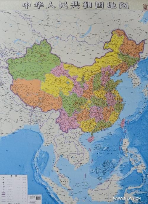
南海诸岛不再以插图形式展现在中国地图上
A publishing company in Central China’s Hunan province has released China’s first map with its islands in the South China Sea in the main illustration, rather than in the inset as in all such maps before.
The new map shows detailed geographic information about China’s Dongsha, Xisha, Nansha and Zhongsha islands. And it is now longer from north to south than west to east, compared with its original version.
Experts say the new map will help people better understand China’s large sea territory.

Lei Yixun, editor-in-chief of Hunan map publishing house shows a vertical atlas of China which is newly-issued by the publishing house in Changsha, capital of central China's Hunan Province, on June 23, 2014. Islands in South China Sea share the same scale with mainland and are better shown than traditional map. (Xinhua/Bai Yu)

Photo taken on June 23, 2014 shows a newly-issued vertical atlas of China by Hunan map publishing house. Islands in South China Sea share the same scale with mainland and are better shown than traditional map. (Xinhua/Bai Yu)